|
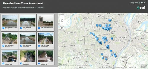
Thanks to a $5,000 grant from REI, the Missouri Stream Team Watershed Coalition (MSTWC) partnered with the River des Peres Watershed Coalition(RdPWC) to encourage and recruit outdoor enthusiasts and Stream Team members into RdPWC efforts. As you can see, the River des Peres has incredible diversity even within the same city. We’ve logged 50 sites around RdP and its tributaries to show you where you can access the creek, what current development looks like, and how it’s laid out on the landscape. This helps you explore, and it can also be useful for showcasing the health of the stream in various water quality issues.
Our interactive map allows you to zoom in and navigate the stream to see what it looks like in different areas. |
Why it’s importantOur monitoring sites are all at or adjacent to trail locations that are fully accessible to hundreds of thousands of users each year. Many of our state’s trail systems were initially positioned adjacent to the waterways, and they provide users an opportunity to connect with water, watch birds and other wildlife, take photographs and find peace by a streamside.
|
Sites we’ve monitored
|
|


